Saint Andrews Rock
Atmospheric conditions from valley to peak
↑ 11549 ft
46°51’N, 121°47’W 🇺🇸
Saturday, August 1
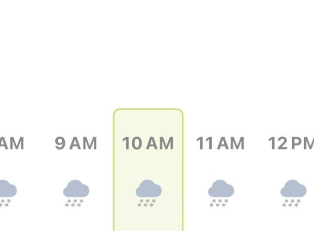
Summit temperature from 32° to 44°, but feels colder because of the wind. Dangerous wind that can knock down even a fit hiker. Clear throughout the day.
2 AM
5 AM
NOW
11 AM
2 PM
5 PM
8 PM
11 PM
Precipitation
No Precipitation
WEAK
MEDIUM
STRONG
43°
41°
38°
34°
32°
33°
33°
33°
19°
12°
8°
5°
3°
3°
1°
5°
8530 ft
50°
47°
44°
41°
39°
38°
38°
37°
34°
28°
24°
21°
18°
17°
16°
18°
5249 ft
57°
53°
50°
50°
49°
47°
46°
44°
51°
45°
41°
41°
37°
34°
33°
33°
Dawn
Sunrise
04:26
05:47
Sunset
Dusk
20:42
22:03
Nearby weather station
Pierce County-Thun Field
↑ 538 ft • 29 mi away • NW
- Feels like
- 61°
- Wind
- 0 mph
- Visibility
- 10 mi
- Humidity
- 88%
- Pressure
- 1020 hPa
More in our app
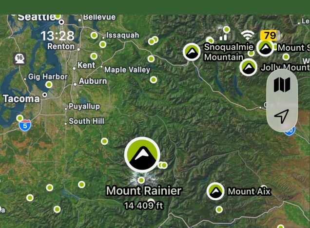
Map of nearest peaks

Easily find peaks on the map and by GPS
Accurate hourly forecast
Plan your mountain trip with maximum precision
More mountain elevations
Forecast for up to 5 different elevations of each peak

7 days forecast ahead
Plan ahead and see how the forecast affects your plans

Map of nearest peaks
Easily find peaks on the map and by GPS
Accurate hourly forecast
Plan your mountain trip with maximum precision
More mountain elevations
Forecast for up to 5 different elevations of each peak
7 days forecast ahead
Plan ahead and see how the forecast affects your plans
Remember!
Mountain weather can be unpredictable. Always pay attention to conditions around you and be prepared for sudden weather changes.